Where is Wharton County, Texas?
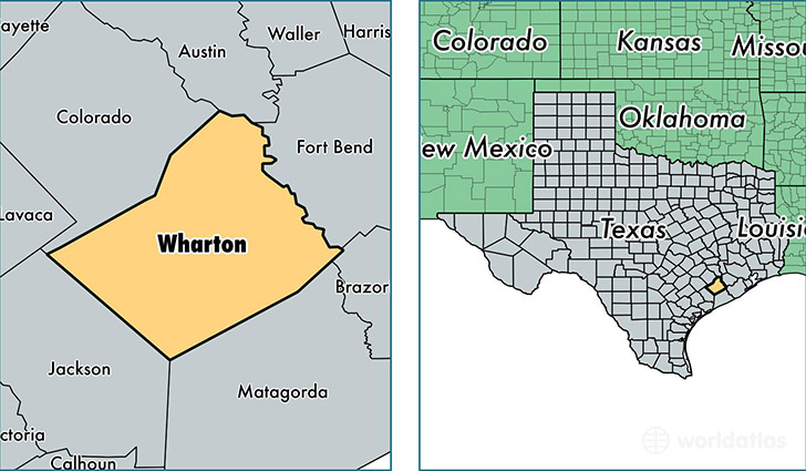
Wharton County is a county equivalent area found in Texas, USA. The county government of Wharton is found in the county seat of Wharton.
With a total 2,834.4 sq. km of land and water area, Wharton County, Texas is the 665th largest county equivalent area in the United States. Home to 41,168 people, Wharton County has a total 17182 households earning 40411 on average per year.
Wharton County, Texas - Quick Facts
| FIPS Code | 48481 |
| Area Codes | 979 |
| Time Zone | CST |
| Major Cities | El Campo (population: 17,056), Wharton (population: 14,149), East Bernard (population: 4,568), Boling (population: 2,205), Louise (population: 2,045), Hungerford (population: 341), Lane City (population: 301), Lissie (population: 217), Danevang (population: 173), Glen Flora (population: 84) |
| Land Area | 15,895 sq miles |
| Water Area | 1,086 sq miles |
| Household Income | $40,411 |
| Housing Units | 17,182 |
| Median Home Value | $95,600 |
| High School Grads | 75% of population |
| Holders of Bachelors Degrees | 15% of population |
| Retail Spending | $11,439 per capita |
| Food & Accomodation Sales | $45,912 per capita |
This page was last updated on June 30, 2016.