Where is Cherokee County, Texas?
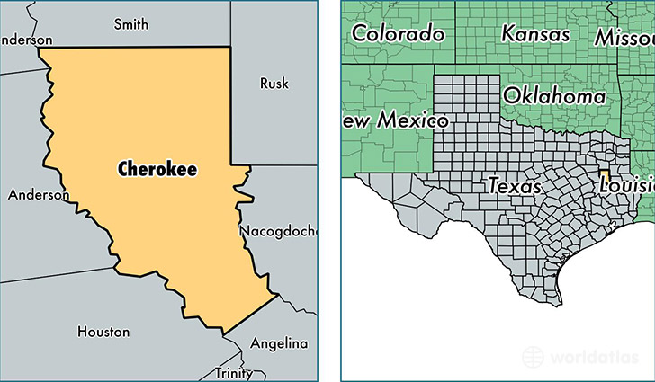
Cherokee County is a county equivalent area found in Texas, USA. The county government of Cherokee is found in the county seat of Rusk.
With a total 2,751.06 sq. km of land and water area, Cherokee County, Texas is the 702nd largest county equivalent area in the United States. Home to 50,902 people, Cherokee County has a total 20833 households earning 38378 on average per year.
Cherokee County, Texas - Quick Facts
| FIPS Code | 48073 |
| Area Codes | 903,936 |
| Time Zone | CST |
| Major Cities | Jacksonville (population: 26,575), Rusk (population: 11,342), Bullard (population: 10,195), Alto (population: 4,208), Wells (population: 832), Reklaw (population: 664), New Summerfield (population: 314), Gallatin (population: 234), Cuney (population: 142) |
| Land Area | 19,653 sq miles |
| Water Area | 1,053 sq miles |
| Household Income | $38,378 |
| Housing Units | 20,833 |
| Median Home Value | $76,300 |
| High School Grads | 77% of population |
| Holders of Bachelors Degrees | 15% of population |
| Retail Spending | $7,547 per capita |
| Food & Accomodation Sales | $36,459 per capita |
This page was last updated on June 30, 2016.