Where is Kay County, Oklahoma?
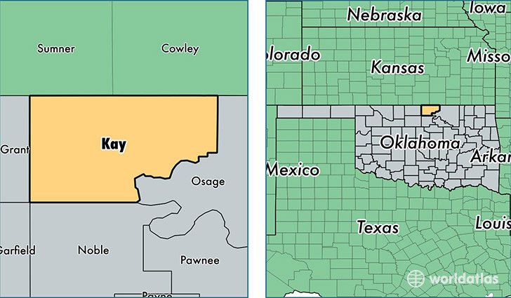
Kay County is a county equivalent area found in Oklahoma, USA. The county government of Kay is found in the county seat of Newkirk.
With a total 2,447.45 sq. km of land and water area, Kay County, Oklahoma is the 846th largest county equivalent area in the United States. Home to 45,478 people, Kay County has a total 21550 households earning 41012 on average per year.
Kay County, Oklahoma - Quick Facts
| FIPS Code | 40071 |
| Area Codes | 580 |
| Time Zone | CST |
| Major Cities | Ponca City (population: 32,117), Blackwell (population: 7,587), Tonkawa (population: 3,831), Newkirk (population: 3,705), Kaw City (population: 703), Braman (population: 568), Nardin (population: 229) |
| Land Area | 17,559 sq miles |
| Water Area | 920 sq miles |
| Household Income | $41,012 |
| Housing Units | 21,550 |
| Median Home Value | $75,700 |
| High School Grads | 86% of population |
| Holders of Bachelors Degrees | 20% of population |
| Retail Spending | $12,543 per capita |
| Food & Accomodation Sales | $61,454 per capita |
This page was last updated on June 30, 2016.