Where is Jefferson County, Ohio?
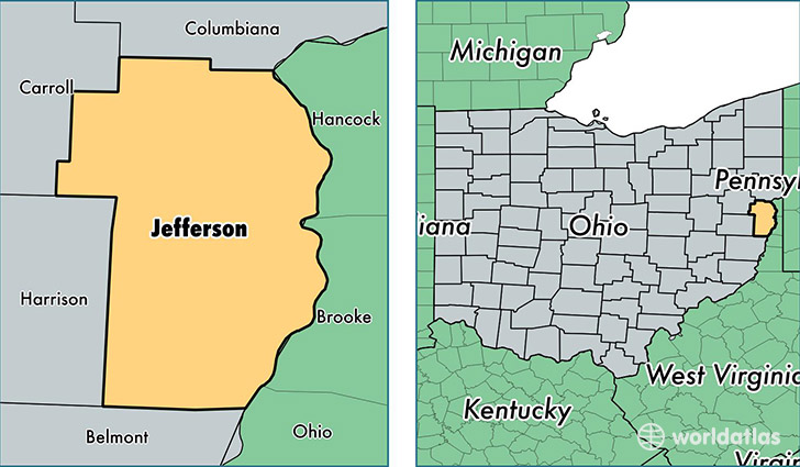
Jefferson County is a county equivalent area found in Ohio, USA. The county government of Jefferson is found in the county seat of Steubenville.
With a total 1,064.36 sq. km of land and water area, Jefferson County, Ohio is the 2536th largest county equivalent area in the United States. Home to 67,694 people, Jefferson County has a total 32475 households earning 40577 on average per year.
Jefferson County, Ohio - Quick Facts
| FIPS Code | 39081 |
| Area Codes | 740 |
| Time Zone | EST |
| Major Cities | Steubenville (population: 30,023), Toronto (population: 9,393), Mingo Junction (population: 5,684), Bloomingdale (population: 3,563), Rayland (population: 3,406), Dillonvale (population: 3,080), Richmond (population: 2,481), Adena (population: 2,182), Bergholz (population: 1,544), Brilliant (population: 1,461) |
| Land Area | 26,137 sq miles |
| Water Area | 408 sq miles |
| Household Income | $40,577 |
| Housing Units | 32,475 |
| Median Home Value | $86,400 |
| High School Grads | 89% of population |
| Holders of Bachelors Degrees | 15% of population |
| Retail Spending | $10,525 per capita |
| Food & Accomodation Sales | $66,322 per capita |
This page was last updated on June 30, 2016.