Where is Delaware County, Ohio?
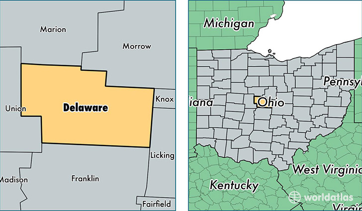
Delaware County is a county equivalent area found in Ohio, USA. The county government of Delaware is found in the county seat of Delaware.
With a total 1,184.48 sq. km of land and water area, Delaware County, Ohio is the 2320th largest county equivalent area in the United States. Home to 189,113 people, Delaware County has a total 68388 households earning 89757 on average per year.
Delaware County, Ohio - Quick Facts
| FIPS Code | 39041 |
| Area Codes | 740,614 |
| Time Zone | EST |
| Major Cities | Delaware (population: 49,995), Powell (population: 40,264), Westerville (population: 31,122), Lewis Center (population: 25,692), Sunbury (population: 12,108), Galena (population: 10,705), Ostrander (population: 4,100), Columbus (population: 3,605), Ashley (population: 3,004), Radnor (population: 1,380) |
| Land Area | 73,017 sq miles |
| Water Area | 443 sq miles |
| Household Income | $89,757 |
| Housing Units | 68,388 |
| Median Home Value | $246,300 |
| High School Grads | 96% of population |
| Holders of Bachelors Degrees | 51% of population |
| Retail Spending | $14,508 per capita |
| Food & Accomodation Sales | $344,178 per capita |
| Universities and Colleges | Ohio Wesleyan University |
This page was last updated on June 30, 2016.