Where is Steuben County, New York?
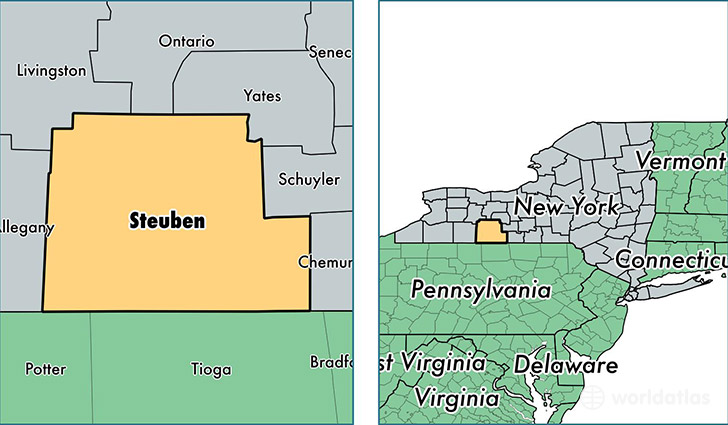
Steuben County is a county equivalent area found in New York, USA. The county government of Steuben is found in the county seat of Bath.
With a total 3,636.56 sq. km of land and water area, Steuben County, New York is the 484th largest county equivalent area in the United States. Home to 98,394 people, Steuben County has a total 48640 households earning 47476 on average per year.
Steuben County, New York - Quick Facts
| FIPS Code | 36101 |
| Area Codes | 585,607 |
| Time Zone | EST |
| Major Cities | Corning (population: 19,864), Hornell (population: 13,051), Bath (population: 12,365), Painted Post (population: 9,829), Addison (population: 5,479), Wayland (population: 5,075), Canisteo (population: 3,756), Campbell (population: 3,316), Arkport (population: 3,071), Hammondsport (population: 3,063) |
| Land Area | 37,990 sq miles |
| Water Area | 1,391 sq miles |
| Household Income | $47,476 |
| Housing Units | 48,640 |
| Median Home Value | $86,800 |
| High School Grads | 88% of population |
| Holders of Bachelors Degrees | 21% of population |
| Retail Spending | $11,168 per capita |
| Food & Accomodation Sales | $103,422 per capita |
This page was last updated on June 30, 2016.