Where is Queens County, New York?
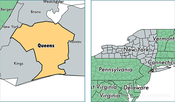
Queens County is a county equivalent area found in New York, USA.
With a total 461.09 sq. km of land and water area, Queens County, New York is the 3051st largest county equivalent area in the United States. Home to 2,321,580 people, Queens County has a total 841190 households earning 57001 on average per year.
Queens is the home to this professional sports team: Mets (MLB)
Queens County, New York - Quick Facts
| FIPS Code | 36081 |
| Area Codes | 718 |
| Time Zone | EST |
| Major Cities | Jamaica (population: 228,673), Flushing (population: 223,474), Astoria (population: 151,273), Corona (population: 112,003), Elmhurst (population: 102,720), Ridgewood (population: 100,450), Woodside (population: 91,523), East Elmhurst (population: 79,756), Far Rockaway (population: 73,306), Forest Hills (population: 70,028) |
| Land Area | 896,367 sq miles |
| Water Area | 109 sq miles |
| Household Income | $57,001 |
| Housing Units | 841,190 |
| Median Home Value | $450,900 |
| High School Grads | 80% of population |
| Holders of Bachelors Degrees | 30% of population |
| Retail Spending | $6,404 per capita |
| Food & Accomodation Sales | $2,223,352 per capita |
| Universities and Colleges | Vaughn College of Aeronautics and Technology, Bramson ORT College, St Vincent Catholic Medical Center School of Nursing-Brooklyn and Queens, Empire Beauty School-Queens, CUNY Queens College, CUNY Queensborough Community College, CUNY School of Law at Queens College, CUNY York College, Midway Paris Beauty School, Rabbinical Seminary of America, Yeshiva Shaar Hatorah |
This page was last updated on June 30, 2016.