Where is Oswego County, New York?
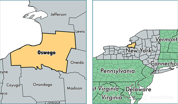
Oswego County is a county equivalent area found in New York, USA. The county government of Oswego is found in the county seat of Oswego.
With a total 3,398.25 sq. km of land and water area, Oswego County, New York is the 515th largest county equivalent area in the United States. Home to 120,913 people, Oswego County has a total 53442 households earning 48051 on average per year.
Oswego County, New York - Quick Facts
| FIPS Code | 36075 |
| Area Codes | 315 |
| Time Zone | EST |
| Major Cities | Oswego (population: 37,080), Fulton (population: 24,847), Central Square (population: 8,650), Phoenix (population: 6,599), Pulaski (population: 6,429), Mexico (population: 6,334), Hannibal (population: 4,472), Pennellville (population: 4,229), Parish (population: 3,881), West Monroe (population: 3,330) |
| Land Area | 46,685 sq miles |
| Water Area | 952 sq miles |
| Household Income | $48,051 |
| Housing Units | 53,442 |
| Median Home Value | $93,000 |
| High School Grads | 86% of population |
| Holders of Bachelors Degrees | 17% of population |
| Retail Spending | $8,186 per capita |
| Food & Accomodation Sales | $128,074 per capita |
This page was last updated on June 30, 2016.