Where is Rolette County, North Dakota?
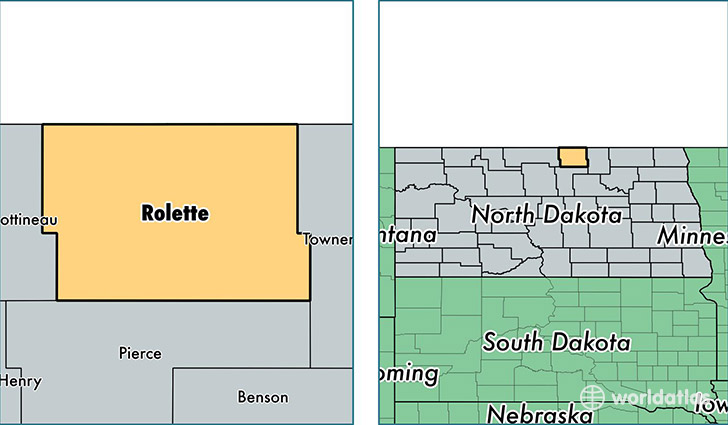
Rolette County is a county equivalent area found in North Dakota, USA. The county government of Rolette is found in the county seat of Rolla.
With a total 2,432.89 sq. km of land and water area, Rolette County, North Dakota is the 854th largest county equivalent area in the United States. Home to 14,616 people, Rolette County has a total 5460 households earning 31336 on average per year.
Rolette County, North Dakota offers the following attraction to visitors: International Peace Garden
Rolette County, North Dakota - Quick Facts
| FIPS Code | 38079 |
| Area Codes | 701 |
| Time Zone | CST |
| Major Cities | Belcourt (population: 6,693), Dunseith (population: 3,418), Rolla (population: 1,761), Saint John (population: 1,270), Rolette (population: 1,114), Agate (population: 252), Mylo (population: 144) |
| Land Area | 5,643 sq miles |
| Water Area | 903 sq miles |
| Household Income | $31,336 |
| Housing Units | 5,460 |
| Median Home Value | $63,400 |
| High School Grads | 82% of population |
| Holders of Bachelors Degrees | 20% of population |
| Retail Spending | $7,847 per capita |
| Food & Accomodation Sales | $36,080 per capita |
| Universities and Colleges | Turtle Mountain Community College |
This page was last updated on June 30, 2016.