Where is McKenzie County, North Dakota?
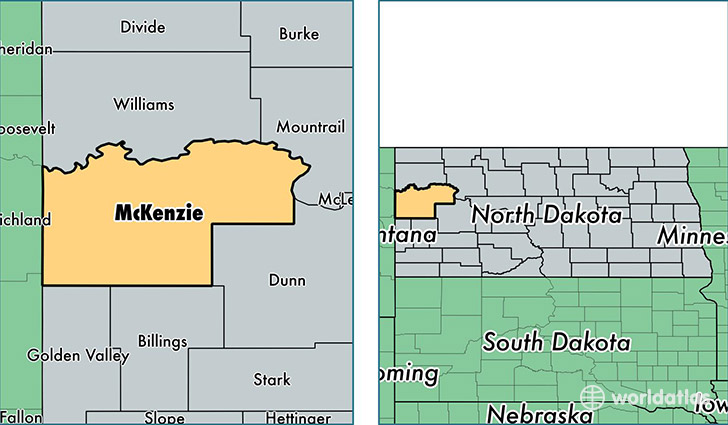
McKenzie County is a county equivalent area found in North Dakota, USA. The county government of McKenzie is found in the county seat of Watford City.
With a total 7,409.38 sq. km of land and water area, McKenzie County, North Dakota is the 196th largest county equivalent area in the United States. Home to 10,996 people, McKenzie County has a total 3547 households earning 64866 on average per year.
McKenzie County, North Dakota offers the following attraction to visitors: Theodore Roosevelt NP
McKenzie County, North Dakota - Quick Facts
| FIPS Code | 38053 |
| Area Codes | 701 |
| Time Zone | CST |
| Major Cities | Watford City (population: 3,520), Alexander (population: 592), Arnegard (population: 393), Keene (population: 355), Grassy Butte (population: 312), Cartwright (population: 249) |
| Land Area | 4,246 sq miles |
| Water Area | 2,760 sq miles |
| Household Income | $64,866 |
| Housing Units | 3,547 |
| Median Home Value | $123,800 |
| High School Grads | 90% of population |
| Holders of Bachelors Degrees | 22% of population |
| Retail Spending | $6,650 per capita |
| Food & Accomodation Sales | $3,514 per capita |
This page was last updated on June 30, 2016.