Where is Fergus County, Montana?
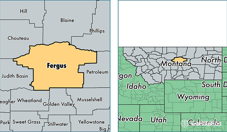
Fergus County is a county equivalent area found in Montana, USA. The county government of Fergus is found in the county seat of Lewistown.
With a total 11,267.98 sq. km of land and water area, Fergus County, Montana is the 113th largest county equivalent area in the United States. Home to 11,442 people, Fergus County has a total 5786 households earning 38344 on average per year.
Fergus County, Montana offers the following attraction to visitors: Upper Missouri River Breaks NM
Fergus County, Montana - Quick Facts
| FIPS Code | 30027 |
| Area Codes | 406 |
| Time Zone | MST |
| Major Cities | Lewistown (population: 8,986), Moore (population: 493), Denton (population: 447), Grass Range (population: 403), Winifred (population: 390), Roy (population: 291), Hilger (population: 237), Coffee Creek (population: 85), Forestgrove (population: 80) |
| Land Area | 4,418 sq miles |
| Water Area | 4,340 sq miles |
| Household Income | $38,344 |
| Housing Units | 5,786 |
| Median Home Value | $113,800 |
| High School Grads | 92% of population |
| Holders of Bachelors Degrees | 26% of population |
| Retail Spending | $12,093 per capita |
| Food & Accomodation Sales | $14,146 per capita |
This page was last updated on June 30, 2016.