Where is Hancock County, Maine?
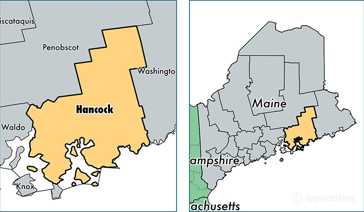
Hancock County is a county equivalent area found in Maine, USA. The county government of Hancock is found in the county seat of Ellsworth.
With a total 6,073.35 sq. km of land and water area, Hancock County, Maine is the 258th largest county equivalent area in the United States. Home to 54,696 people, Hancock County has a total 40283 households earning 47460 on average per year.
Hancock County, Maine offers the following attraction to visitors: Acadia NP
Hancock County, Maine - Quick Facts
| FIPS Code | 23009 |
| Area Codes | 207 |
| Time Zone | EST |
| Major Cities | Ellsworth (population: 13,007), Bucksport (population: 5,482), Bar Harbor (population: 5,235), Holden (population: 4,717), Blue Hill (population: 2,585), Hancock (population: 2,266), Orland (population: 2,149), Franklin (population: 1,927), Southwest Harbor (population: 1,771), Deer Isle (population: 1,640) |
| Land Area | 21,118 sq miles |
| Water Area | 1,587 sq miles |
| Household Income | $47,460 |
| Housing Units | 40,283 |
| Median Home Value | $198,300 |
| High School Grads | 93% of population |
| Holders of Bachelors Degrees | 33% of population |
| Retail Spending | $15,363 per capita |
| Food & Accomodation Sales | $167,455 per capita |
| Universities and Colleges | Maine Maritime Academy |
This page was last updated on June 30, 2016.