Where is Geary County, Kansas?
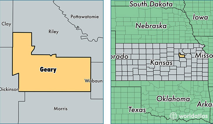
Geary County is a county equivalent area found in Kansas, USA. The county government of Geary is found in the county seat of Junction City.
With a total 1,047.61 sq. km of land and water area, Geary County, Kansas is the 2579th largest county equivalent area in the United States. Home to 36,713 people, Geary County has a total 14946 households earning 46908 on average per year.
Geary County, Kansas - Quick Facts
| FIPS Code | 20061 |
| Area Codes | 785 |
| Time Zone | CST |
| Major Cities | Junction City (population: 29,572), Fort Riley (population: 15,424), Milford (population: 1,833) |
| Land Area | 14,175 sq miles |
| Water Area | 385 sq miles |
| Household Income | $46,908 |
| Housing Units | 14,946 |
| Median Home Value | $136,500 |
| High School Grads | 91% of population |
| Holders of Bachelors Degrees | 21% of population |
| Retail Spending | $9,992 per capita |
| Food & Accomodation Sales | $51,976 per capita |
This page was last updated on June 30, 2016.