Where is Cowley County, Kansas?
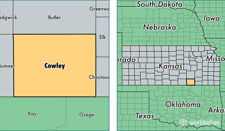
Cowley County is a county equivalent area found in Kansas, USA. The county government of Cowley is found in the county seat of Winfield.
With a total 2,932.97 sq. km of land and water area, Cowley County, Kansas is the 640th largest county equivalent area in the United States. Home to 35,963 people, Cowley County has a total 15941 households earning 41878 on average per year.
Cowley County, Kansas - Quick Facts
| FIPS Code | 20035 |
| Area Codes | 620 |
| Time Zone | CST |
| Major Cities | Arkansas City (population: 16,524), Winfield (population: 15,259), Udall (population: 1,826), Burden (population: 944), Dexter (population: 601), Atlanta (population: 555), Rock (population: 257), Cambridge (population: 229), Maple City (population: 47) |
| Land Area | 13,885 sq miles |
| Water Area | 1,126 sq miles |
| Household Income | $41,878 |
| Housing Units | 15,941 |
| Median Home Value | $80,600 |
| High School Grads | 88% of population |
| Holders of Bachelors Degrees | 20% of population |
| Retail Spending | $9,291 per capita |
| Food & Accomodation Sales | $34,235 per capita |
| Universities and Colleges | Southwestern College |
This page was last updated on June 30, 2016.