Where is Bourbon County, Kansas?
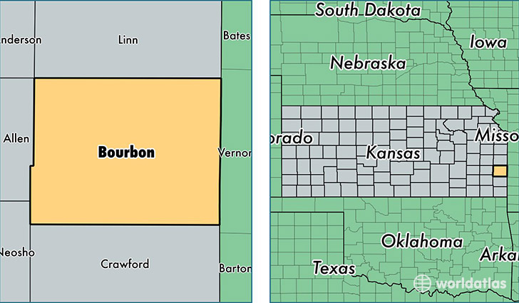
Bourbon County is a county equivalent area found in Kansas, USA. The county government of Bourbon is found in the county seat of Fort Scott.
With a total 1,655.24 sq. km of land and water area, Bourbon County, Kansas is the 1615th largest county equivalent area in the United States. Home to 14,772 people, Bourbon County has a total 7082 households earning 39591 on average per year.
Bourbon County, Kansas offers the following attraction to visitors: Fort Scott NHS
Bourbon County, Kansas - Quick Facts
| FIPS Code | 20011 |
| Area Codes | 620 |
| Time Zone | CST |
| Major Cities | Fort Scott (population: 12,101), Uniontown (population: 638), Walnut (population: 589), Bronson (population: 557), Redfield (population: 546), Mapleton (population: 442), Fulton (population: 369), Garland (population: 232) |
| Land Area | 5,703 sq miles |
| Water Area | 636 sq miles |
| Household Income | $39,591 |
| Housing Units | 7,082 |
| Median Home Value | $78,400 |
| High School Grads | 88% of population |
| Holders of Bachelors Degrees | 22% of population |
| Retail Spending | $8,136 per capita |
| Food & Accomodation Sales | $16,285 per capita |
This page was last updated on June 30, 2016.