Where is Winnebago County, Illinois?
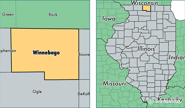
Winnebago County is a county equivalent area found in Illinois, USA. The county government of Winnebago is found in the county seat of Rockford.
With a total 1,344.85 sq. km of land and water area, Winnebago County, Illinois is the 2107th largest county equivalent area in the United States. Home to 288,542 people, Winnebago County has a total 125445 households earning 47072 on average per year.
Winnebago County, Illinois - Quick Facts
| FIPS Code | 17201 |
| Area Codes | 815 |
| Time Zone | CST |
| Major Cities | Rockford (population: 187,116), Loves Park (population: 23,248), Machesney Park (population: 22,929), Roscoe (population: 19,835), Rockton (population: 11,669), South Beloit (population: 10,485), Winnebago (population: 5,954), Cherry Valley (population: 4,788), Pecatonica (population: 4,086), Durand (population: 2,591) |
| Land Area | 111,407 sq miles |
| Water Area | 514 sq miles |
| Household Income | $47,072 |
| Housing Units | 125,445 |
| Median Home Value | $123,400 |
| High School Grads | 86% of population |
| Holders of Bachelors Degrees | 21% of population |
| Retail Spending | $12,943 per capita |
| Food & Accomodation Sales | $452,187 per capita |
| Universities and Colleges | Regency Beauty Institute-Rockford |
This page was last updated on June 30, 2016.