Where is Rock Island County, Illinois?
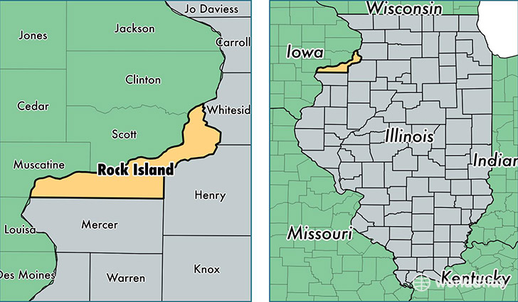
Rock Island County is a county equivalent area found in Illinois, USA. The county government of Rock Island is found in the county seat of Rock Island.
With a total 1,168.83 sq. km of land and water area, Rock Island County, Illinois is the 2341st largest county equivalent area in the United States. Home to 146,063 people, Rock Island County has a total 65593 households earning 48702 on average per year.
Rock Island County, Illinois - Quick Facts
| FIPS Code | 17161 |
| Area Codes | 309 |
| Time Zone | CST |
| Major Cities | Moline (population: 45,071), Rock Island (population: 39,092), East Moline (population: 24,038), Milan (population: 10,540), Silvis (population: 7,804), Coal Valley (population: 5,860), Port Byron (population: 4,344), Taylor Ridge (population: 2,290), Hampton (population: 1,820), Andalusia (population: 1,283) |
| Land Area | 56,395 sq miles |
| Water Area | 427 sq miles |
| Household Income | $48,702 |
| Housing Units | 65,593 |
| Median Home Value | $113,800 |
| High School Grads | 87% of population |
| Holders of Bachelors Degrees | 22% of population |
| Retail Spending | $11,636 per capita |
| Food & Accomodation Sales | $224,219 per capita |
This page was last updated on June 30, 2016.