Where is Cass County, Iowa?
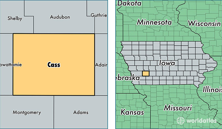
Cass County is a county equivalent area found in Iowa, USA. The county government of Cass is found in the county seat of Atlantic.
With a total 1,463.21 sq. km of land and water area, Cass County, Iowa is the 1956th largest county equivalent area in the United States. Home to 13,448 people, Cass County has a total 6546 households earning 43481 on average per year.
Cass County, Iowa - Quick Facts
| FIPS Code | 19029 |
| Area Codes | 712 |
| Time Zone | CST |
| Major Cities | Atlantic (population: 8,351), Griswold (population: 1,895), Anita (population: 1,382), Lewis (population: 709), Massena (population: 690), Cumberland (population: 585), Wiota (population: 391), Marne (population: 296) |
| Land Area | 5,192 sq miles |
| Water Area | 564 sq miles |
| Household Income | $43,481 |
| Housing Units | 6,546 |
| Median Home Value | $88,100 |
| High School Grads | 93% of population |
| Holders of Bachelors Degrees | 19% of population |
| Retail Spending | $12,846 per capita |
| Food & Accomodation Sales | $11,638 per capita |
This page was last updated on June 30, 2016.