Where is Shasta County, California?
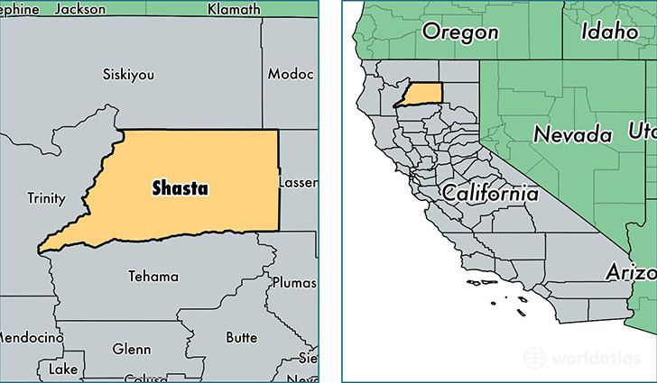
Shasta County is a county equivalent area found in California, USA. The county government of Shasta is found in the county seat of Redding.
With a total 9,964.72 sq. km of land and water area, Shasta County, California is the 133rd largest county equivalent area in the United States. Home to 179,804 people, Shasta County has a total 77536 households earning 44651 on average per year.
Shasta County, California offers the following attraction to visitors: Lassen Volcanic NP
Shasta County, California - Quick Facts
| FIPS Code | 6089 |
| Area Codes | 530 |
| Time Zone | PST |
| Major Cities | Redding (population: 112,574), Anderson (population: 23,016), Shasta Lake (population: 10,159), Shingletown (population: 4,540), Burney (population: 4,244), Palo Cedro (population: 4,113), Fall River Mills (population: 1,475), Bella Vista (population: 1,240), Lakehead (population: 1,147), Millville (population: 1,113) |
| Land Area | 69,423 sq miles |
| Water Area | 3,775 sq miles |
| Household Income | $44,651 |
| Housing Units | 77,536 |
| Median Home Value | $220,000 |
| High School Grads | 88% of population |
| Holders of Bachelors Degrees | 19% of population |
| Retail Spending | $14,088 per capita |
| Food & Accomodation Sales | $280,996 per capita |
This page was last updated on June 30, 2016.