Zagros Mountains
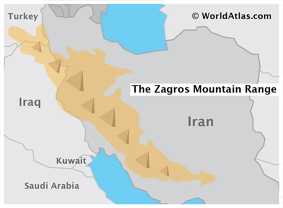
The Zagros Mountain, a major mountain range in Central Asia, extends for a distance of 1,500 kilometers in a northwest to southeast direction from the border areas between eastern Turkey and northern Iraq across the Iranian Plateau, ending at the Strait of Hormuz in southern Iran. Mount Dena, with a peak achieving an elevation of 14,465 feet, is the highest peak in the Zagros Mountain system. Limestone and shale rocks from the Mesozoic Era and Paleogene Period form the most commonly seen geological structural materials of the Zagros Mountains. The oldest rocks found here date back to the Precambrian Period.
Climate
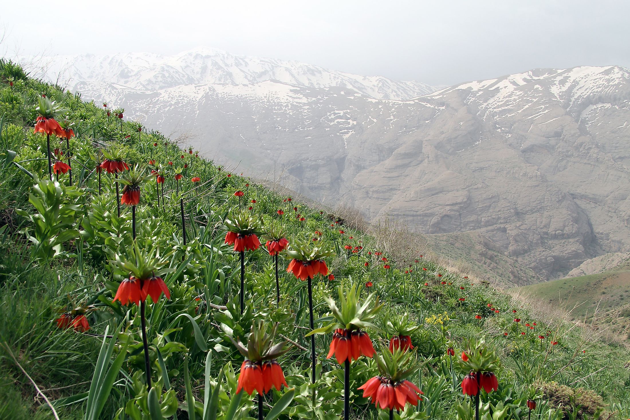
The World Wide Fund for Nature defines the ecosystems of the Zagros Mountain region as the "Zagros Mountains forest steppe ecoregion". A semi-arid temperate climate prevails in the region, wherein the bitter winters are severely cold and experience deadly temperatures drop, while summers are highly arid. Average annual precipitation ranges between 400 millimeters and 800 millimeters, and mostly falls during the late winter and early spring seasons.
Ecosystems And Wildlife In The Zagros Mountains

Temperate broad-leaved forests, dominated by oak and pistachio trees, as well as dense ground covers of steppe vegetation, form the major types of vegetation cover seen in the Zagros ecoregion. Persian oak is the most important plant species of these ecosystems. Mammals like wild goats, leopards, brown bears, wolves, martens, and mongooses, and such birds species as eagles, partridges, bustards, and black vultures, as well as a number of other rare and elusive animal species all inhabit the Zagros Mountain ecoregion. This group includes the five endemic lizard species that also call the Zagros Mountains their home. The Lesser spotted eagle and the Golden eagle can be observed nesting in the hills and mountains of the region, and such "endangered" species as the Persian Fallow Deer and Basra Reed Warbler also live in the Zagros Mountains.
Human History In The Zagros Mountains

Scientists estimate that the Zagros Mountains were formed during orogenic episodes triggered by the sliding of the Arabian Plate underneath the Eurasian Plate during the Miocene and Pliocene Epochs. Historically, the Zagros Mountains have acted as a natural barrier between several cultures and empires of the ancient and modern worlds alike. Specifically, they have defined parts of the kingdom and national boundaries of the native Persian and Ottoman Empires and the foreign Parthian and Roman Empires.
Evidence of human habitation and agriculture has been discovered in the mountain's habitats dating to as far back as 9,000 BCE. Wine is though to have been produced in the region as early as 5,400 BCE. The Zagros Mountains also served as the home for several culturally distinct groups, including the Assyrians, Kassites, Elamites, Gutis, and others.
Current Inhabitants Of The Zagros Mountains

The Zagros Mountain region is currently inhabited by a significant portion of the Iranian population, including a diverse mix of ethnic and religious groups, comprised by Assyrian Christians, Turks, and Kurds, as well as a number of smaller tribal groups. Livestock raising is the dominant occupation of the inhabitants of this region, while carpet and rug production and crop agriculture also act as other sources of livelihood. Petroleum reserves have also been located in the southwestern foothills of the mountain range, generating a significant source of economic revenues for the region. A number of Iranian cities, including Esfahan, Shiraz, Dezful and Borujerd, are located in the Zagros Mountains region.
Threats

Overgrazing is the greatest threat to the Zagros Mountain ecoregion, where native vegetation has greatly shrunk over the past few decades due to extensive grazing by human-bred livestock. Several protected areas, like the Arjan Protected Area and Biosphere Reserve and The Mooteh Protected Area, have been established in the mountainous region to protect the rapidly disappearing flora and fauna of the ecosystem. Besides clearance of land for agriculture and livestock grazing, the hunting and poaching of wild species also poses a severe threat to their survival.
Ten Highest Peaks
| Peak Name | Height in Meteres | Height in Feet |
|---|---|---|
| Dena | 4,409 | 14,465 |
| Zard Kuh | 4,221 | 13,848 |
| Oshtoran Kuh | 4,139 | 13,579 |
| Kuh-e Gereh | 3,990 | 13,091 |
| Kuh-e Bul | 3,943 | 12,936 |
| Kuh-e Darabshah | 3,900 | 12,795 |
| Kuh-e Hezar Darreh | 3,880 | 12,730 |
| Menar | 3,750 | 12,303 |
| Kuh-e Rag | 3,661 | 12,011 |
| Kuh-e Garin | 3,630 | 11,909 |