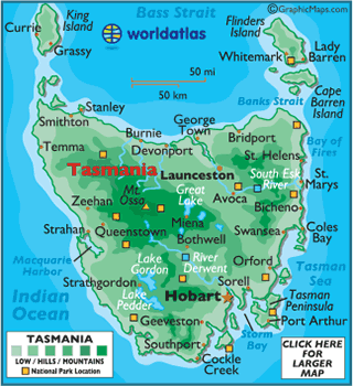
Tasmania
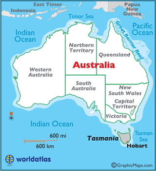
Located 150 miles (240 km) south of
Australia, separated by the Bass Strait, the state of Tasmania includes the main island, as well as the surrounding 334 islands. Tasmania is surrounded by both the
Indian Pacific OceansGeographically, the island of Tasmania is similar to New Zealand, and is Australia's most mountainous state. The Central Highlands dominate the central and western parts of the state, while the central eastern Midlands are fairly flat.
Much of Tasmania is densely forested, with the Southwest National Park being home to some of the last temperate rainforests in the Southern Hemisphere. In the island's far northwestern region, the Tarkine is the largest temperate rainforest in Australia, and covers roughly 1,500 sq. miles (3,800 sq. km).
There are a great number of rivers within Tasmania, due to its rugged topography, the most notable of which include the Derwent and South Esk Rivers. The major lakes of Tasmania are Lake Pedder, Lake Gordon, and the Great Lake.
Tasmania's highest point is Mount Ossa at 5,305 ft. (1,617 m), and it's lowest is the Indian Ocean (0 m).