Bonaire
The Island of Bonaire is a special municipality of the Netherlands that is located in the southern Caribbean Sea. Along with the islands of Aruba and Curaçao, Bonaire forms a part of the ABC Islands which are the westernmost island group in the Leeward Antilles.
Bonaire is situated about 80 km to the north of Venezuela and about 32 km to the east of Curaçao Island. Unlike the other Caribbean islands, the islands of Bonaire, Aruba, and Curaçao are located outside Hurricane Alley of the Caribbean Sea. Bonaire was previously a part of the Netherland Antilles, and currently, along with the islands of Saba and Sint Eustatius, it forms a part of the Caribbean Netherlands.
Geography

The island is positioned on South America’s continental shelf. Like the other islands of the Greater and Lesser Antilles, Bonaire was formed when a large mass of rock was forced out to the sea’s surface by the continental shelf. After the formation of the island, vast amounts of corals were deposited on its surface which later slowly developed into limestone deposits.
Covering a total area of 294 km2, Bonaire has a length of about 38.6 km (north to south) and its width ranges from 4.8 to 8 km. The northern part of the island is quite hilly in comparison to its mostly flat southern part. Located in the Washington Slagbaai National Park in the island’s northern portion is Brandaris Hill, which rises to an elevation of 240 m and is the highest point on the Island. The southern part of the island includes Lac Bay which consists of huge mangrove forests. A major part of the island’s southern region is filled with seawater, where the evaporated salt is collected. The shoreline of Bonaire contains many inlets and lagoons, among which the Goto Lake is the largest.
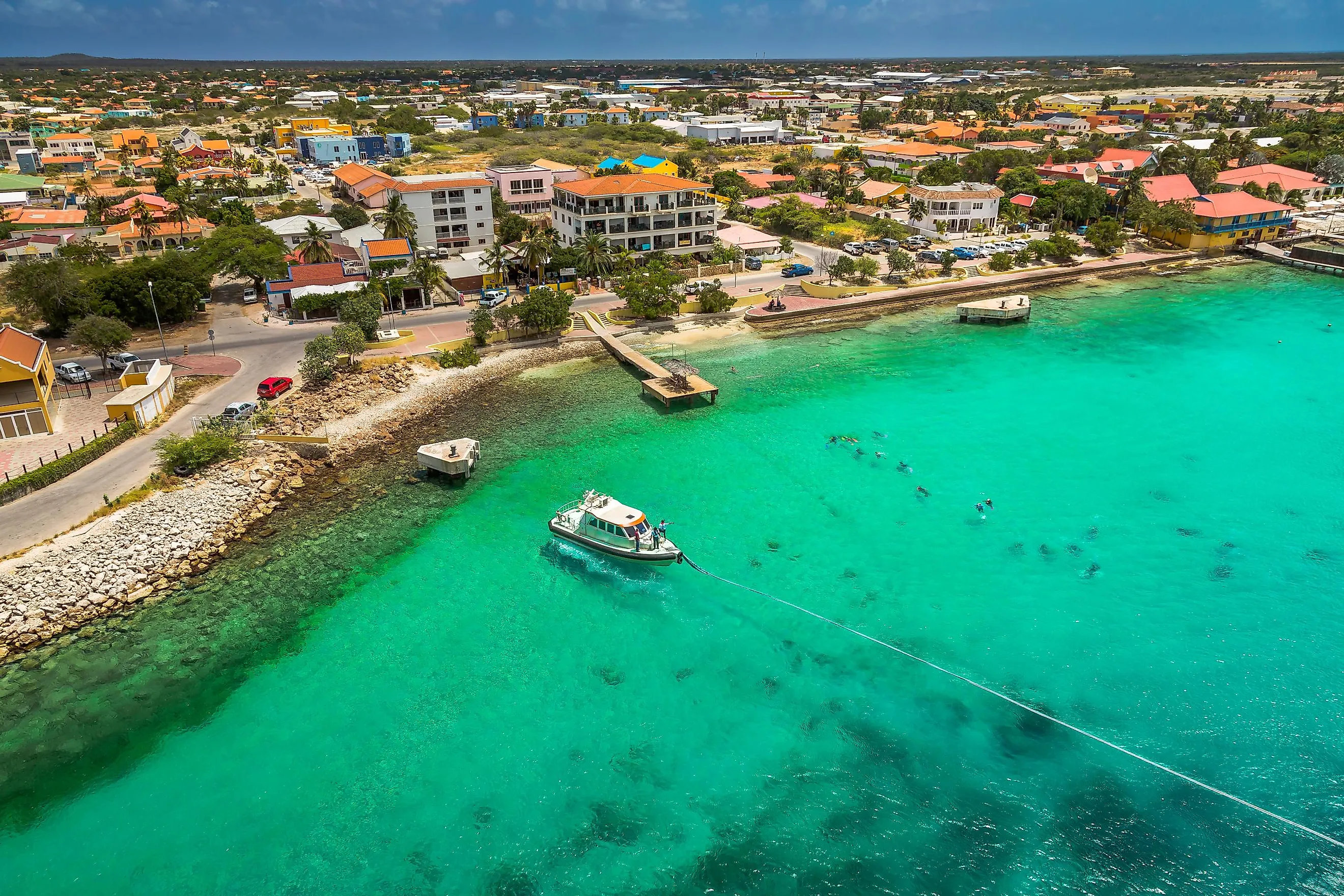
Bonaire experiences a warm, dry, and windy climate with average temperatures of about 27.5 °C. The dry easterly winds bring 520 mm of annual rainfall, mostly between October and January. Located in the southwestern part of Bonaire Island is Kralendijk, the island’s capital city and its principal port. Kralendijk serves as an important commercial and cultural hub for the island. Bonaire also includes the small uninhabited islet of Klein Bonaire, which is situated about 800 m to the west of Bonaire and occupies a land area of only 6 km2.
Wildlife

Bonaire is surrounded by coral reefs that host more than 60 soft and stony coral species and 350 species of fish. The most common coral that is found here is the Boulder Star Coral. In 2011, the highly venomous Bonaire banded box jellyfish was discovered on the island by marine biologists. The wetlands and lagoons of the island serve as critical habitats for a large number of shorebirds. The island is also known for its donkey sanctuary and as important breeding grounds for the Caribbean flamingo. The yellow-shouldered Amazon parrot is also found on the Bonaire island. The coral reefs and the beaches of both the islands of Bonaire and Klein Bonaire are protected under the Bonaire National Marine Park.
Brief History

The Indigenous Arkaiko people were the original inhabitants of the island and their presence on the island can be traced back to 2500 BCE. In 1000 CE, the Caquetio people, a branch of the Arawak, arrived on the island by canoe from neighboring Venezuela. In 1499, three European explorers, namely Alonso de Ojeda, Amerigo Vespucci, and Juan de la Cosa arrived in Bonaire and Curaçao island. The explorers considered the three ABC Islands to be worthless and therefore deported the Indigenous inhabitants as slaves to the copper mines on Hispaniola Island.
In March 1636, following the Eighty Years War, Bonaire was taken over by the Dutch. The British gained control over the island twice during the Napoleonic Wars. Under the Anglo-Dutch Treaty of 1814, the ABC Islands were returned to the Netherlands. The island served as a government plantation from 1816 to 1868. During World War II, Bonaire served as a protectorate of the United Kingdom from 1940 to 1942 and as a United States protectorate from 1942 to 1945. In 1954, Bonaire became a part of the Netherland Antilles. In October 2010, the Netherland Antilles was dissolved and after its dissolution, each of the three Islands of Bonaire, Saba and Sint Eustatius were given the status of a special municipality by the Government of Netherlands.
Economy Of Bonaire
Tourism forms the backbone of Bonaire's economy. Its tropical climate, stunning natural scenery, beaches, well-preserved coral reefs offering scuba diving and snorkeling make it a tourist hotspot. Many cruise lines also use Bonaire as one of their ports of call in the Caribbean. Bonaire used the US dollar as its currency as it is the most convenient currency for tourism in the area. The US dollar replaced the region's former currency, the Netherlands Antillean guilder in 2011.