Maps of Iraq

With an area of 437,072 sq. km, Iraq is the 58th largest country in the world.
The country exhibits four major physiographic regions as mentioned below.
The alluvial plains cover about one-third of the country's area in the central and southeastern parts. The elevation of land here is generally below 300 feet (100 m). As observed on the physical map of Iraq, this region also features several lakes.
The Al-Jazīrah is an upland region to the north of the alluvial plains and between the Tigris and Euphrates Rivers. The Sinjār Mountains is found here.
Iraq is mountainous further to the north and northeast, as the Zagros Mountains front its borders with Iran and Turkey. The country's highest point is located there, an unnamed peak rising 11,847 ft (3,611 m).
The Syrian Desert lies to the extreme west of Iraq.
Two of the most significant rivers in all of Asia, the Euphrates and Tigris Rivers, drain the land.
The lowest point in Iraq is at 0 ft (0 m) in the Persian Gulf.
Governorates of Iraq Map

Iraq (officially, Republic of Iraq) is divided into 18 governorates (muhafazat, sing- muhafazah) and 1 autonomous region. In alphabetical order, these governorates are: Al Anbar, Babil, Baghdad, Al Basrah, DiQar, Al Qadisiyah, Diyala, Dahuk, Erbil, Hewler (Halabja), Karbala, Kirkuk, Maysan, Al Muthanna, An Najaf, Ninawa (Nineveh), Salahad Din and Wasit. Kurdistan (Kurdistan Region) is an autonomous region in Iraq. These governorates are further subdivided into districts (qadhas) and sub districts (nawahi).
Baghdad is the capital city of the Republic of Iraq. It is located in the center of the country, in the northern part of the Arabian Peninsula. Located along both the banks of the Tigris River, the city is the largest in entire Southwest Asia. Baghdad is the most populous city as well as the cultural, commercial and economic center of Iraq.
Where is Iraq?

Iraq is a sovereign Western Asian country. It is located in Northern and Eastern hemispheres of the Earth. It is bordered by six nations: Iran to the East; Kuwait to the southeast; Turkey to the north; Syria to the west; Jordan to the southwest and Saudi Arabia to the south. The country has a short 36 miles (58 km) coastline along the northern end of the Persian Gulf.
Iraq Bordering Countries: Saudi Arabia, Jordan, Syria, Turkey, Kuwait, Iran.
Regional Maps: Map of Asia
Outline Map of Iraq

The blank outline map represents the country of Iraq in Western Asia. The country is mostly bounded by land but has a small coast on the Persian Gulf. The map can be dowloaded, printed, and used for coloring or educational purpose.

The outline map above represents the country of Iraq in Western Asia.
Key Facts
| Legal Name | Republic of Iraq |
|---|---|
| Flag |
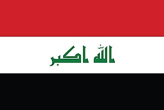
|
| Capital City | Baghdad |
| 33 20 N, 44 24 E | |
| Total Area | 438,317.00 km2 |
| Land Area | 437,367.00 km2 |
| Water Area | 950.00 km2 |
| Population | 39,309,783 |
| Major Cities |
|
| Currency | Iraqi dinars (IQD) |
| GDP | $234.09 Billion |
| GDP Per Capita | $5,955.11 |
This page was last updated on February 24, 2021