Where is Oconto County, Wisconsin?
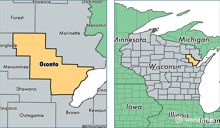
Oconto County is a county equivalent area found in Wisconsin, USA. The county government of Oconto is found in the county seat of Oconto.
With a total 2,975.37 sq. km of land and water area, Oconto County, Wisconsin is the 622nd largest county equivalent area in the United States. Home to 37,417 people, Oconto County has a total 23572 households earning 51615 on average per year.
Oconto County, Wisconsin - Quick Facts
| FIPS Code | 55083 |
| Area Codes | 920,715 |
| Time Zone | CST |
| Major Cities | Oconto (population: 7,210), Oconto Falls (population: 5,515), Gillett (population: 3,863), Sobieski (population: 3,342), Lena (population: 3,078), Suring (population: 3,001), Abrams (population: 2,735), Little Suamico (population: 2,534), Mountain (population: 1,177), Townsend (population: 1,012) |
| Land Area | 14,447 sq miles |
| Water Area | 998 sq miles |
| Household Income | $51,615 |
| Housing Units | 23,572 |
| Median Home Value | $147,700 |
| High School Grads | 89% of population |
| Holders of Bachelors Degrees | 15% of population |
| Retail Spending | $6,897 per capita |
| Food & Accomodation Sales | $28,196 per capita |
This page was last updated on June 30, 2016.