Where is La Crosse County, Wisconsin?
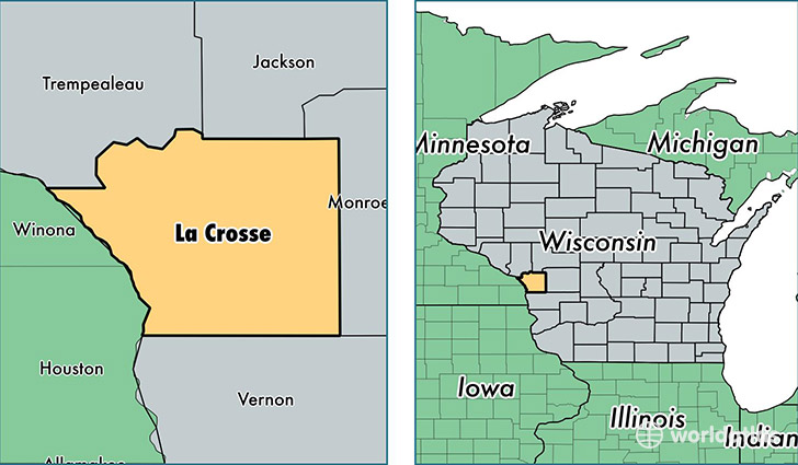
La Crosse County is a county equivalent area found in Wisconsin, USA. The county government of La Crosse is found in the county seat of La Crosse.
With a total 1,243.19 sq. km of land and water area, La Crosse County, Wisconsin is the 2244th largest county equivalent area in the United States. Home to 118,011 people, La Crosse County has a total 48815 households earning 51339 on average per year.
La Crosse County, Wisconsin - Quick Facts
| FIPS Code | 55063 |
| Area Codes | 608 |
| Time Zone | CST |
| Major Cities | La Crosse (population: 64,597), Onalaska (population: 23,748), Holmen (population: 13,955), West Salem (population: 7,740), Bangor (population: 2,993), Mindoro (population: 1,456), Rockland (population: 907) |
| Land Area | 45,564 sq miles |
| Water Area | 452 sq miles |
| Household Income | $51,339 |
| Housing Units | 48,815 |
| Median Home Value | $154,700 |
| High School Grads | 94% of population |
| Holders of Bachelors Degrees | 30% of population |
| Retail Spending | $16,142 per capita |
| Food & Accomodation Sales | $214,449 per capita |
| Universities and Colleges | Viterbo University |
This page was last updated on June 30, 2016.