Where is Lincoln County, Washington?
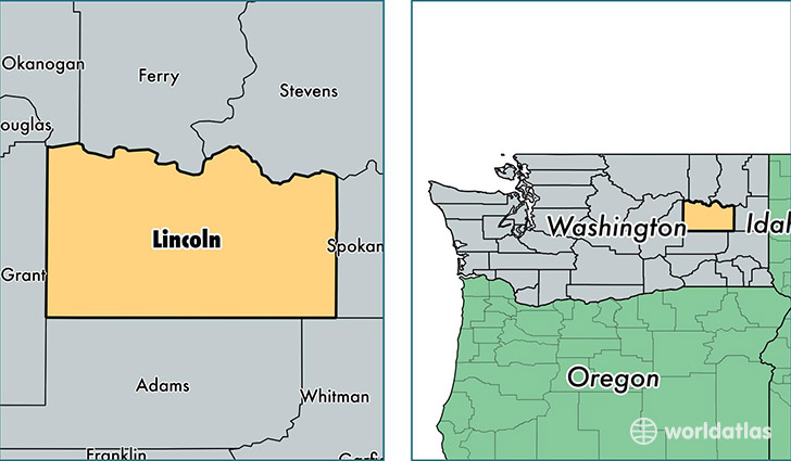
Lincoln County is a county equivalent area found in Washington, USA. The county government of Lincoln is found in the county seat of Davenport.
With a total 6,058.9 sq. km of land and water area, Lincoln County, Washington is the 259th largest county equivalent area in the United States. Home to 10,250 people, Lincoln County has a total 5788 households earning 47195 on average per year.
Lincoln County, Washington - Quick Facts
| FIPS Code | 53043 |
| Area Codes | 509 |
| Time Zone | PST |
| Major Cities | Davenport (population: 3,725), Odessa (population: 1,362), Reardan (population: 1,279), Wilbur (population: 1,278), Sprague (population: 682), Edwall (population: 639), Harrington (population: 634), Almira (population: 492), Creston (population: 478), Lincoln (population: 187) |
| Land Area | 3,958 sq miles |
| Water Area | 2,310 sq miles |
| Household Income | $47,195 |
| Housing Units | 5,788 |
| Median Home Value | $155,700 |
| High School Grads | 94% of population |
| Holders of Bachelors Degrees | 20% of population |
| Retail Spending | $8,923 per capita |
| Food & Accomodation Sales | $4,020 per capita |
This page was last updated on June 30, 2016.