Where is Utah County, Utah?
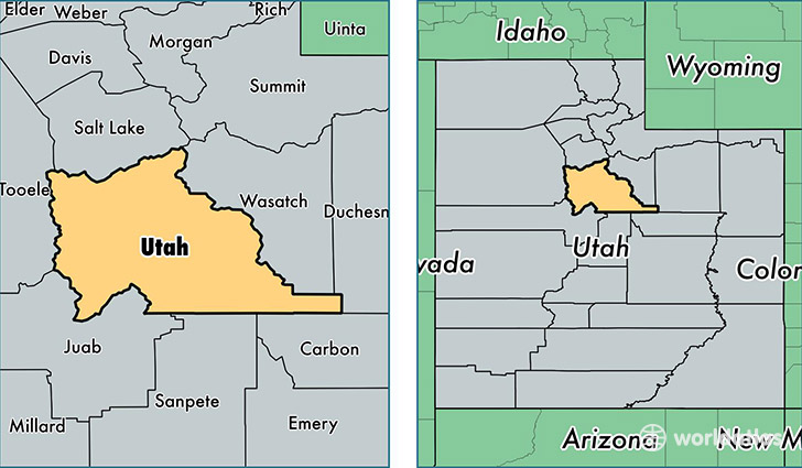
Utah County is a county equivalent area found in Utah, USA. The county government of Utah is found in the county seat of Provo.
With a total 5,553.13 sq. km of land and water area, Utah County, Utah is the 293rd largest county equivalent area in the United States. Home to 560,974 people, Utah County has a total 154064 households earning 60196 on average per year.
Utah County, Utah offers the following attraction to visitors: Timpanogos Cave NM
Utah County, Utah - Quick Facts
| FIPS Code | 49049 |
| Area Codes | 801 |
| Time Zone | MST |
| Major Cities | Provo (population: 118,156), Orem (population: 92,630), Lehi (population: 51,302), Pleasant Grove (population: 45,274), American Fork (population: 44,348), Spanish Fork (population: 39,755), Springville (population: 31,364), Payson (population: 24,544), Eagle Mountain (population: 22,402), Saratoga Springs (population: 17,657) |
| Land Area | 216,593 sq miles |
| Water Area | 2,003 sq miles |
| Household Income | $60,196 |
| Housing Units | 154,064 |
| Median Home Value | $222,100 |
| High School Grads | 94% of population |
| Holders of Bachelors Degrees | 37% of population |
| Retail Spending | $11,254 per capita |
| Food & Accomodation Sales | $451,687 per capita |
| Universities and Colleges | Brigham Young University, Provo College |
This page was last updated on June 30, 2016.