Where is Garfield County, Utah?
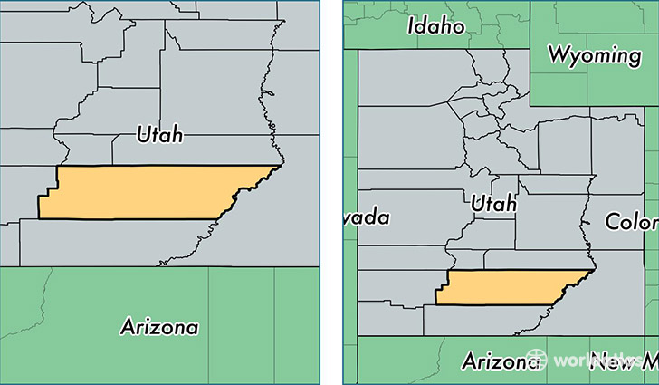
Garfield County is a county equivalent area found in Utah, USA. The county government of Garfield is found in the county seat of Panguitch.
With a total 13,489.27 sq. km of land and water area, Garfield County, Utah is the 78th largest county equivalent area in the United States. Home to 5,024 people, Garfield County has a total 3768 households earning 45357 on average per year.
Garfield County, Utah offers the following attraction to visitors: Bryce Canyon NP
Garfield County, Utah - Quick Facts
| FIPS Code | 49017 |
| Area Codes | 435 |
| Time Zone | MST |
| Major Cities | Panguitch (population: 2,080), Escalante (population: 946), Tropic (population: 529), Bryce (population: 326), Boulder (population: 292), Hatch (population: 254), Henrieville (population: 242), Antimony (population: 197), Cannonville (population: 186) |
| Land Area | 1,940 sq miles |
| Water Area | 5,175 sq miles |
| Household Income | $45,357 |
| Housing Units | 3,768 |
| Median Home Value | $154,300 |
| High School Grads | 92% of population |
| Holders of Bachelors Degrees | 20% of population |
| Retail Spending | $5,094 per capita |
| Food & Accomodation Sales | $49,289 per capita |
This page was last updated on June 30, 2016.