Where is Cameron County, Texas?
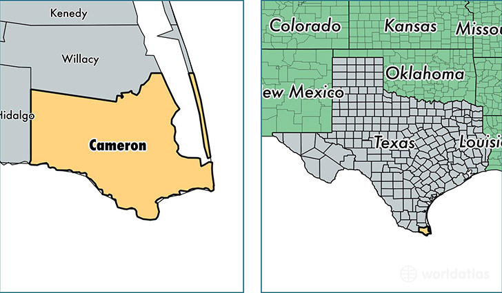
Cameron County is a county equivalent area found in Texas, USA. The county government of Cameron is found in the county seat of Brownsville.
With a total 3,306.01 sq. km of land and water area, Cameron County, Texas is the 541st largest county equivalent area in the United States. Home to 420,392 people, Cameron County has a total 144515 households earning 33179 on average per year.
Cameron County, Texas offers the following attraction to visitors: Palo Alto Battlefield NHP
Cameron County, Texas - Quick Facts
| FIPS Code | 48061 |
| Area Codes | 956 |
| Time Zone | CST |
| Major Cities | Brownsville (population: 200,182), Harlingen (population: 89,268), San Benito (population: 57,162), Los Fresnos (population: 16,603), La Feria (population: 13,044), Port Isabel (population: 12,803), Olmito (population: 8,241), Rio Hondo (population: 6,775), Santa Rosa (population: 6,469), South Padre Island (population: 2,951) |
| Land Area | 162,314 sq miles |
| Water Area | 891 sq miles |
| Household Income | $33,179 |
| Housing Units | 144,515 |
| Median Home Value | $78,300 |
| High School Grads | 64% of population |
| Holders of Bachelors Degrees | 15% of population |
| Retail Spending | $10,221 per capita |
| Food & Accomodation Sales | $503,079 per capita |
This page was last updated on June 30, 2016.