Where is Bexar County, Texas?
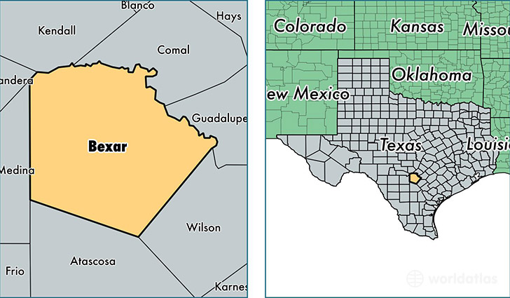
Bexar County is a county equivalent area found in Texas, USA. The county government of Bexar is found in the county seat of San Antonio.
With a total 3,253.22 sq. km of land and water area, Bexar County, Texas is the 551st largest county equivalent area in the United States. Home to 1,855,866 people, Bexar County has a total 674332 households earning 50112 on average per year.
Bexar County, Texas offers the following attractions to visitors: SeaWorld San Antonio, Six Flags Fiesta Texas, San Antonio Missions NHP
Bexar is the home to this professional sports team: San Antonio Spurs (NBA)
Bexar County, Texas - Quick Facts
| FIPS Code | 48029 |
| Area Codes | 210 |
| Time Zone | CST |
| Major Cities | San Antonio (population: 1,637,659), Converse (population: 36,034), Helotes (population: 25,321), Universal City (population: 20,972), JBSA Lackland (population: 10,821), Boerne (population: 10,103), Atascosa (population: 8,596), Von Ormy (population: 8,500), Elmendorf (population: 8,268), Adkins (population: 8,196) |
| Land Area | 716,554 sq miles |
| Water Area | 1,240 sq miles |
| Household Income | $50,112 |
| Housing Units | 674,332 |
| Median Home Value | $123,700 |
| High School Grads | 83% of population |
| Holders of Bachelors Degrees | 26% of population |
| Retail Spending | $14,359 per capita |
| Food & Accomodation Sales | $3,829,048 per capita |
| Universities and Colleges | Mims Classic Beauty College, Northwest Vista College, Baptist University of the Americas |
This page was last updated on June 30, 2016.