Where is Roberts County, South Dakota?
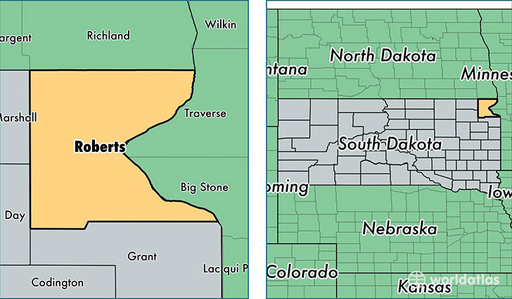
Roberts County is a county equivalent area found in South Dakota, USA. The county government of Roberts is found in the county seat of Sisseton.
With a total 2,941.63 sq. km of land and water area, Roberts County, South Dakota is the 635th largest county equivalent area in the United States. Home to 10,374 people, Roberts County has a total 4903 households earning 47191 on average per year.
Roberts County, South Dakota - Quick Facts
| FIPS Code | 46109 |
| Area Codes | 605 |
| Time Zone | CST |
| Major Cities | Sisseton (population: 5,036), Rosholt (population: 1,109), Wilmot (population: 1,074), Peever (population: 822), New Effington (population: 546), Corona (population: 440), Claire City (population: 197) |
| Land Area | 4,005 sq miles |
| Water Area | 1,101 sq miles |
| Household Income | $47,191 |
| Housing Units | 4,903 |
| Median Home Value | $83,000 |
| High School Grads | 88% of population |
| Holders of Bachelors Degrees | 17% of population |
| Retail Spending | $8,149 per capita |
| Food & Accomodation Sales | $7,226 per capita |
| Universities and Colleges | Sisseton Wahpeton College |
This page was last updated on June 30, 2016.