Where is Westmoreland County, Pennsylvania?
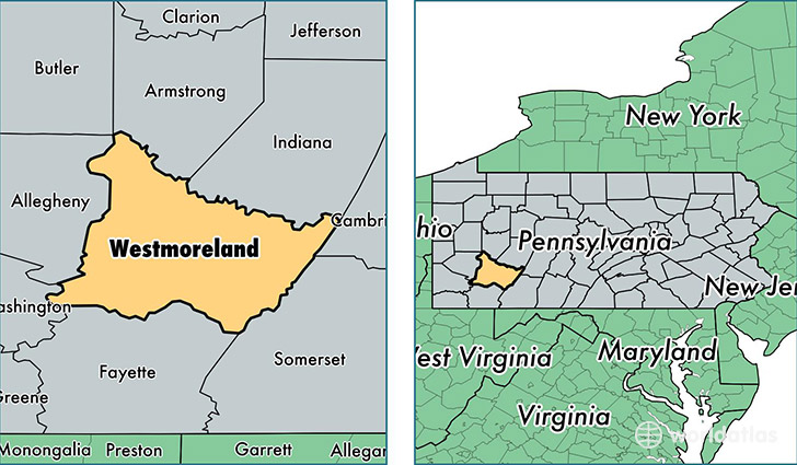
Westmoreland County is a county equivalent area found in Pennsylvania, USA. The county government of Westmoreland is found in the county seat of Greensburg.
With a total 2,683.42 sq. km of land and water area, Westmoreland County, Pennsylvania is the 731st largest county equivalent area in the United States. Home to 359,320 people, Westmoreland County has a total 167673 households earning 50736 on average per year.
Westmoreland County, Pennsylvania - Quick Facts
| FIPS Code | 42129 |
| Area Codes | 724,412 |
| Time Zone | EST |
| Major Cities | Greensburg (population: 59,194), Irwin (population: 45,067), New Kensington (population: 38,642), Latrobe (population: 28,293), Jeannette (population: 18,744), Mount Pleasant (population: 16,377), Apollo (population: 13,850), Murrysville (population: 13,075), Export (population: 9,317), Vandergrift (population: 9,024) |
| Land Area | 138,734 sq miles |
| Water Area | 1,027 sq miles |
| Household Income | $50,736 |
| Housing Units | 167,673 |
| Median Home Value | $133,600 |
| High School Grads | 92% of population |
| Holders of Bachelors Degrees | 25% of population |
| Retail Spending | $11,441 per capita |
| Food & Accomodation Sales | $454,326 per capita |
| Universities and Colleges | Pennsylvania State University-Penn State New Kensington, Saint Vincent College, Seton Hill University, Westmoreland County Community College |
This page was last updated on June 30, 2016.