Where is Somerset County, Pennsylvania?
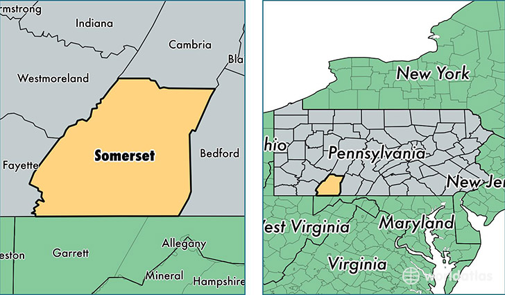
Somerset County is a county equivalent area found in Pennsylvania, USA. The county government of Somerset is found in the county seat of Somerset.
With a total 2,799.6 sq. km of land and water area, Somerset County, Pennsylvania is the 682nd largest county equivalent area in the United States. Home to 76,218 people, Somerset County has a total 37809 households earning 43597 on average per year.
Somerset County, Pennsylvania offers the following attraction to visitors: Flight 93 NMEM
Somerset County, Pennsylvania - Quick Facts
| FIPS Code | 42111 |
| Area Codes | 814 |
| Time Zone | EST |
| Major Cities | Somerset (population: 18,896), Windber (population: 10,989), Meyersdale (population: 6,053), Berlin (population: 5,313), Boswell (population: 3,822), Friedens (population: 3,683), Rockwood (population: 3,646), Stoystown (population: 3,311), Central City (population: 2,648), Hollsopple (population: 2,593) |
| Land Area | 29,428 sq miles |
| Water Area | 1,075 sq miles |
| Household Income | $43,597 |
| Housing Units | 37,809 |
| Median Home Value | $98,400 |
| High School Grads | 86% of population |
| Holders of Bachelors Degrees | 15% of population |
| Retail Spending | $9,838 per capita |
| Food & Accomodation Sales | $81,350 per capita |
This page was last updated on June 30, 2016.