Where is Lackawanna County, Pennsylvania?
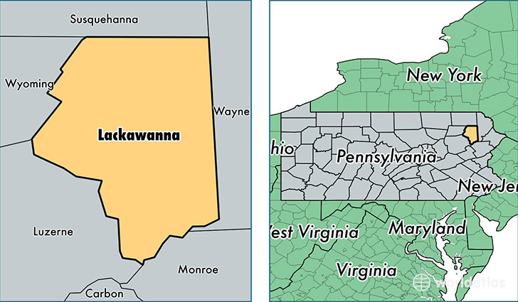
Lackawanna County is a county equivalent area found in Pennsylvania, USA. The county government of Lackawanna is found in the county seat of Scranton.
With a total 1,204.11 sq. km of land and water area, Lackawanna County, Pennsylvania is the 2302nd largest county equivalent area in the United States. Home to 212,719 people, Lackawanna County has a total 96367 households earning 46044 on average per year.
Lackawanna County, Pennsylvania offers the following attraction to visitors: Steamtown NHS
Lackawanna County, Pennsylvania - Quick Facts
| FIPS Code | 42069 |
| Area Codes | 570 |
| Time Zone | EST |
| Major Cities | Scranton (population: 100,369), Clarks Summit (population: 21,989), Carbondale (population: 13,859), Moscow (population: 13,752), Olyphant (population: 10,549), Old Forge (population: 8,314), Archbald (population: 7,088), Jermyn (population: 6,509), Dalton (population: 5,444), Taylor (population: 5,274) |
| Land Area | 82,131 sq miles |
| Water Area | 459 sq miles |
| Household Income | $46,044 |
| Housing Units | 96,367 |
| Median Home Value | $144,100 |
| High School Grads | 89% of population |
| Holders of Bachelors Degrees | 26% of population |
| Retail Spending | $15,185 per capita |
| Food & Accomodation Sales | $360,487 per capita |
| Universities and Colleges | Empire Beauty School-Wyoming Valley |
This page was last updated on June 30, 2016.