Where is Jefferson County, Pennsylvania?
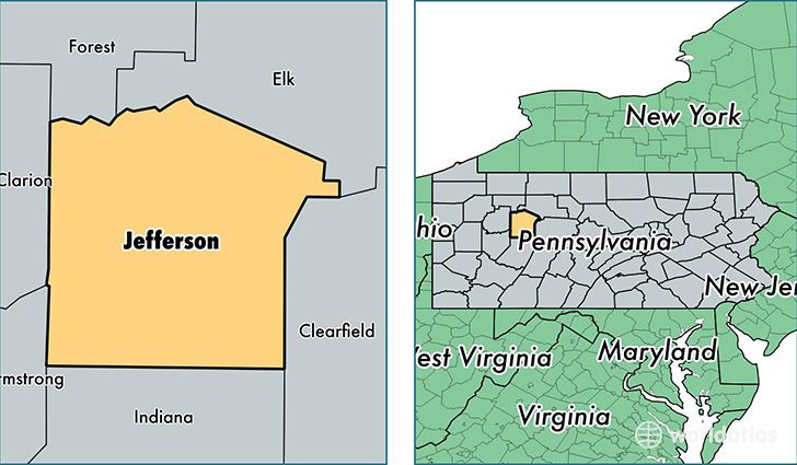
Jefferson County is a county equivalent area found in Pennsylvania, USA. The county government of Jefferson is found in the county seat of Brookville.
With a total 1,701.11 sq. km of land and water area, Jefferson County, Pennsylvania is the 1551st largest county equivalent area in the United States. Home to 44,638 people, Jefferson County has a total 22323 households earning 41262 on average per year.
Jefferson County, Pennsylvania - Quick Facts
| FIPS Code | 42065 |
| Area Codes | 814 |
| Time Zone | EST |
| Major Cities | Punxsutawney (population: 14,528), Brookville (population: 9,469), Reynoldsville (population: 6,606), Brockway (population: 5,355), Falls Creek (population: 1,974), Summerville (population: 1,827), Mayport (population: 1,519), Sykesville (population: 1,282), Corsica (population: 1,262), Sigel (population: 1,054) |
| Land Area | 17,235 sq miles |
| Water Area | 653 sq miles |
| Household Income | $41,262 |
| Housing Units | 22,323 |
| Median Home Value | $86,800 |
| High School Grads | 88% of population |
| Holders of Bachelors Degrees | 13% of population |
| Retail Spending | $10,594 per capita |
| Food & Accomodation Sales | $32,316 per capita |
This page was last updated on June 30, 2016.