Where is Greene County, Pennsylvania?
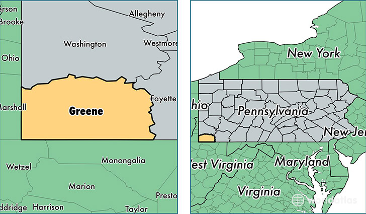
Greene County is a county equivalent area found in Pennsylvania, USA. The county government of Greene is found in the county seat of Waynesburg.
With a total 1,496.95 sq. km of land and water area, Greene County, Pennsylvania is the 1844th largest county equivalent area in the United States. Home to 37,843 people, Greene County has a total 16349 households earning 44388 on average per year.
Greene County, Pennsylvania - Quick Facts
| FIPS Code | 42059 |
| Area Codes | 724 |
| Time Zone | EST |
| Major Cities | Waynesburg (population: 14,639), Carmichaels (population: 5,300), Mount Morris (population: 1,710), Rices Landing (population: 1,635), Greensboro (population: 1,581), Dilliner (population: 1,503), Jefferson (population: 1,427), New Freeport (population: 971), Nemacolin (population: 887), Holbrook (population: 855) |
| Land Area | 14,611 sq miles |
| Water Area | 576 sq miles |
| Household Income | $44,388 |
| Housing Units | 16,349 |
| Median Home Value | $89,400 |
| High School Grads | 85% of population |
| Holders of Bachelors Degrees | 16% of population |
| Retail Spending | $10,998 per capita |
| Food & Accomodation Sales | $36,814 per capita |
This page was last updated on June 30, 2016.