Where is Delaware County, Pennsylvania?
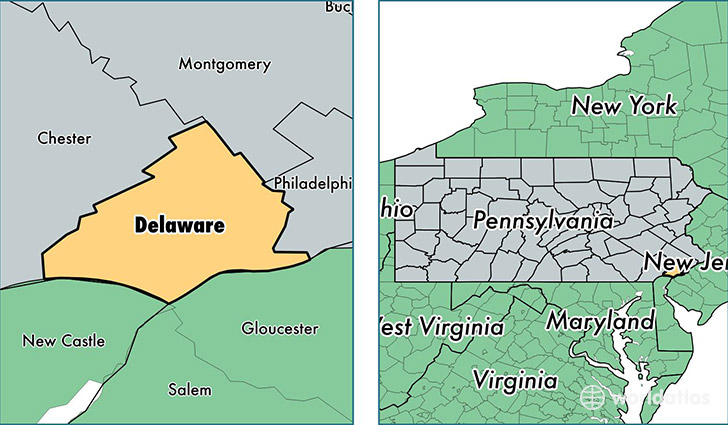
Delaware County is a county equivalent area found in Pennsylvania, USA. The county government of Delaware is found in the county seat of Media.
With a total 493.66 sq. km of land and water area, Delaware County, Pennsylvania is the 3037th largest county equivalent area in the United States. Home to 562,960 people, Delaware County has a total 221669 households earning 64041 on average per year.
Delaware County, Pennsylvania - Quick Facts
| FIPS Code | 42045 |
| Area Codes | 610 |
| Time Zone | EST |
| Major Cities | Upper Darby (population: 41,152), Havertown (population: 36,014), Media (population: 35,839), Chester (population: 35,263), Wayne (population: 32,542), Drexel Hill (population: 30,854), Lansdowne (population: 28,179), Springfield (population: 24,551), Clifton Heights (population: 23,448), Darby (population: 22,248) |
| Land Area | 217,360 sq miles |
| Water Area | 184 sq miles |
| Household Income | $64,041 |
| Housing Units | 221,669 |
| Median Home Value | $234,100 |
| High School Grads | 92% of population |
| Holders of Bachelors Degrees | 35% of population |
| Retail Spending | $11,456 per capita |
| Food & Accomodation Sales | $779,477 per capita |
| Universities and Colleges | Cabrini College |
This page was last updated on June 30, 2016.