Where is Klamath County, Oregon?
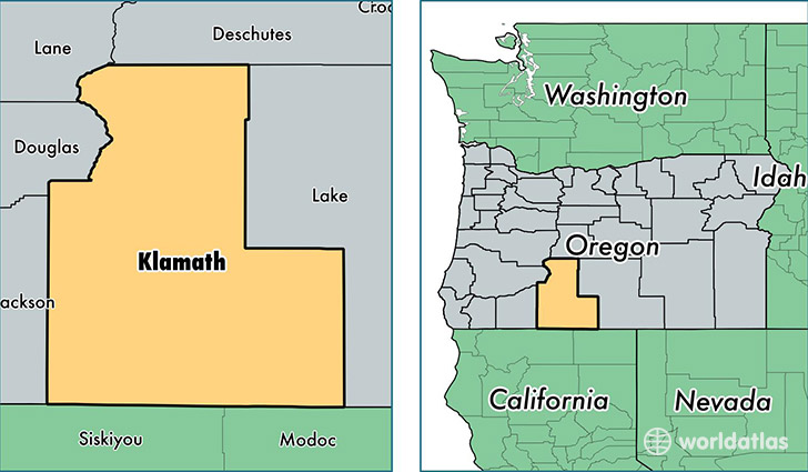
Klamath County is a county equivalent area found in Oregon, USA. The county government of Klamath is found in the county seat of Klamath Falls.
With a total 15,890.99 sq. km of land and water area, Klamath County, Oregon is the 61st largest county equivalent area in the United States. Home to 65,455 people, Klamath County has a total 32642 households earning 39627 on average per year.
Klamath County, Oregon offers the following attraction to visitors: Crater Lake NP
Klamath County, Oregon - Quick Facts
| FIPS Code | 41035 |
| Area Codes | 541 |
| Time Zone | PST |
| Major Cities | Klamath Falls (population: 51,616), Chiloquin (population: 3,475), Bonanza (population: 2,293), Malin (population: 1,455), Merrill (population: 1,351), Keno (population: 774), Crescent (population: 764), Sprague River (population: 565), Bly (population: 554), Gilchrist (population: 492) |
| Land Area | 25,272 sq miles |
| Water Area | 5,941 sq miles |
| Household Income | $39,627 |
| Housing Units | 32,642 |
| Median Home Value | $155,000 |
| High School Grads | 88% of population |
| Holders of Bachelors Degrees | 20% of population |
| Retail Spending | $11,845 per capita |
| Food & Accomodation Sales | $103,007 per capita |
This page was last updated on June 30, 2016.