Where is Osage County, Oklahoma?
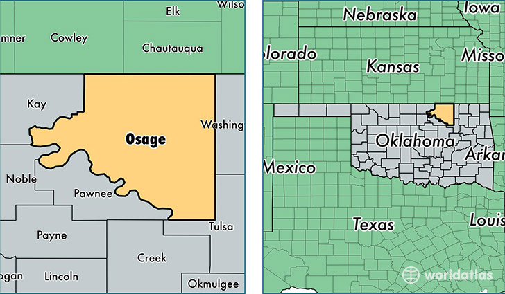
Osage County is a county equivalent area found in Oklahoma, USA. The county government of Osage is found in the county seat of Pawhuska.
With a total 5,967.28 sq. km of land and water area, Osage County, Oklahoma is the 267th largest county equivalent area in the United States. Home to 47,981 people, Osage County has a total 21262 households earning 44195 on average per year.
Osage County, Oklahoma - Quick Facts
| FIPS Code | 40113 |
| Area Codes | 918 |
| Time Zone | CST |
| Major Cities | Skiatook (population: 14,089), Pawhuska (population: 5,773), Hominy (population: 4,607), Barnsdall (population: 2,354), Fairfax (population: 1,916), Shidler (population: 904), Osage (population: 851), Wynona (population: 633), Prue (population: 591), Burbank (population: 475) |
| Land Area | 18,526 sq miles |
| Water Area | 2,246 sq miles |
| Household Income | $44,195 |
| Housing Units | 21,262 |
| Median Home Value | $93,900 |
| High School Grads | 88% of population |
| Holders of Bachelors Degrees | 16% of population |
| Retail Spending | $3,801 per capita |
| Food & Accomodation Sales | $18,150 per capita |
This page was last updated on June 30, 2016.