Where is Blaine County, Oklahoma?
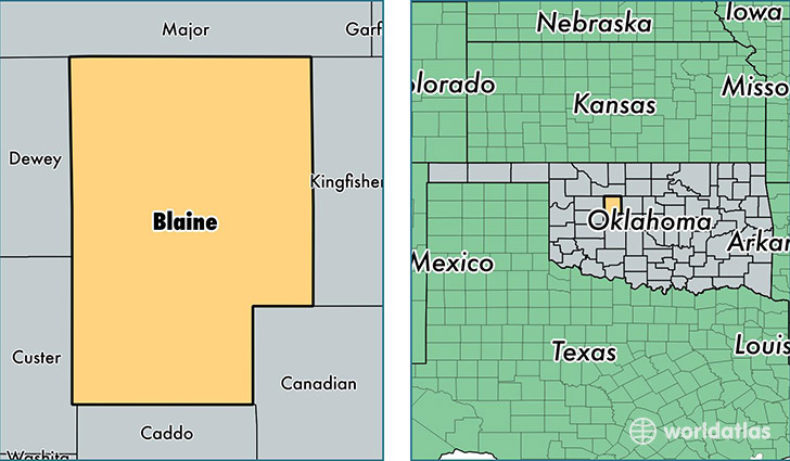
Blaine County is a county equivalent area found in Oklahoma, USA. The county government of Blaine is found in the county seat of Watonga.
With a total 2,431.46 sq. km of land and water area, Blaine County, Oklahoma is the 856th largest county equivalent area in the United States. Home to 9,917 people, Blaine County has a total 5154 households earning 44206 on average per year.
Blaine County, Oklahoma - Quick Facts
| FIPS Code | 40011 |
| Area Codes | 405,580 |
| Time Zone | CST |
| Major Cities | Watonga (population: 5,013), Geary (population: 1,747), Okeene (population: 1,346), Canton (population: 1,009), Longdale (population: 783), Hitchcock (population: 218), Greenfield (population: 102) |
| Land Area | 3,829 sq miles |
| Water Area | 929 sq miles |
| Household Income | $44,206 |
| Housing Units | 5,154 |
| Median Home Value | $68,000 |
| High School Grads | 83% of population |
| Holders of Bachelors Degrees | 17% of population |
| Retail Spending | $5,917 per capita |
| Food & Accomodation Sales | $8,940 per capita |
This page was last updated on June 30, 2016.