Where is Williams County, Ohio?
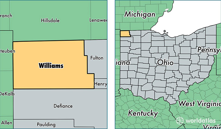
Williams County is a county equivalent area found in Ohio, USA. The county government of Williams is found in the county seat of Bryan.
With a total 1,095.8 sq. km of land and water area, Williams County, Ohio is the 2478th largest county equivalent area in the United States. Home to 37,291 people, Williams County has a total 16503 households earning 43089 on average per year.
Williams County, Ohio - Quick Facts
| FIPS Code | 39171 |
| Area Codes | 419 |
| Time Zone | EST |
| Major Cities | Bryan (population: 14,776), Montpelier (population: 7,744), Edgerton (population: 3,726), Stryker (population: 3,381), West Unity (population: 3,095), Edon (population: 2,716), Pioneer (population: 2,399), Alvordton (population: 785), Kunkle (population: 215), Blakeslee (population: 95) |
| Land Area | 14,398 sq miles |
| Water Area | 421 sq miles |
| Household Income | $43,089 |
| Housing Units | 16,503 |
| Median Home Value | $98,600 |
| High School Grads | 89% of population |
| Holders of Bachelors Degrees | 13% of population |
| Retail Spending | $8,708 per capita |
| Food & Accomodation Sales | $33,732 per capita |
This page was last updated on June 30, 2016.