Where is Putnam County, Ohio?
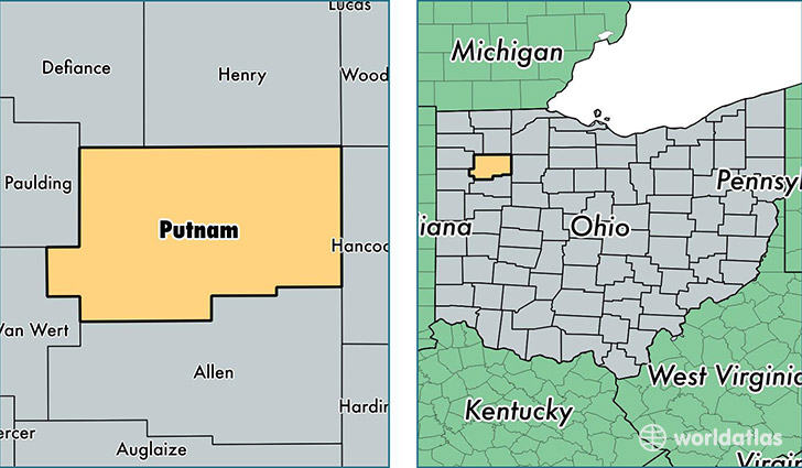
Putnam County is a county equivalent area found in Ohio, USA. The county government of Putnam is found in the county seat of Ottawa.
With a total 1,254.33 sq. km of land and water area, Putnam County, Ohio is the 2229th largest county equivalent area in the United States. Home to 34,171 people, Putnam County has a total 13722 households earning 61192 on average per year.
Putnam County, Ohio - Quick Facts
| FIPS Code | 39137 |
| Area Codes | 419 |
| Time Zone | EST |
| Major Cities | Ottawa (population: 10,893), Columbus Grove (population: 6,170), Leipsic (population: 5,149), Fort Jennings (population: 3,227), Continental (population: 3,153), Cloverdale (population: 2,346), Pandora (population: 2,120), Kalida (population: 1,426), Ottoville (population: 855), Miller City (population: 161) |
| Land Area | 13,193 sq miles |
| Water Area | 483 sq miles |
| Household Income | $61,192 |
| Housing Units | 13,722 |
| Median Home Value | $133,500 |
| High School Grads | 92% of population |
| Holders of Bachelors Degrees | 20% of population |
| Retail Spending | $7,300 per capita |
| Food & Accomodation Sales | $23,206 per capita |
This page was last updated on June 30, 2016.