Where is Miami County, Ohio?
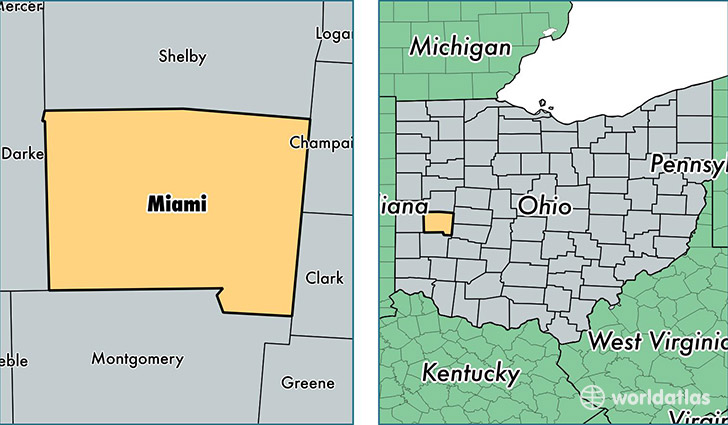
Miami County is a county equivalent area found in Ohio, USA. The county government of Miami is found in the county seat of Troy.
With a total 1,061. sq. km of land and water area, Miami County, Ohio is the 2547th largest county equivalent area in the United States. Home to 103,900 people, Miami County has a total 44162 households earning 52040 on average per year.
Miami County, Ohio - Quick Facts
| FIPS Code | 39109 |
| Area Codes | 937 |
| Time Zone | EST |
| Major Cities | Troy (population: 35,320), Piqua (population: 25,300), Tipp City (population: 18,431), West Milton (population: 7,075), Covington (population: 5,393), Pleasant Hill (population: 1,980), Laura (population: 1,695), Casstown (population: 1,442), Ludlow Falls (population: 1,240), Fletcher (population: 1,185) |
| Land Area | 40,116 sq miles |
| Water Area | 407 sq miles |
| Household Income | $52,040 |
| Housing Units | 44,162 |
| Median Home Value | $133,700 |
| High School Grads | 88% of population |
| Holders of Bachelors Degrees | 20% of population |
| Retail Spending | $10,704 per capita |
| Food & Accomodation Sales | $127,602 per capita |
This page was last updated on June 30, 2016.