Where is Fairfield County, Ohio?
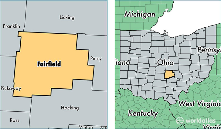
Fairfield County is a county equivalent area found in Ohio, USA. The county government of Fairfield is found in the county seat of Lancaster.
With a total 1,317.17 sq. km of land and water area, Fairfield County, Ohio is the 2142nd largest county equivalent area in the United States. Home to 150,381 people, Fairfield County has a total 59242 households earning 58786 on average per year.
Fairfield County, Ohio - Quick Facts
| FIPS Code | 39045 |
| Area Codes | 740,614 |
| Time Zone | EST |
| Major Cities | Lancaster (population: 60,107), Pickerington (population: 38,786), Baltimore (population: 8,220), Carroll (population: 4,658), Amanda (population: 4,550), Millersport (population: 3,425), Stoutsville (population: 3,181), Bremen (population: 3,179), Sugar Grove (population: 2,554), Rushville (population: 2,496) |
| Land Area | 58,062 sq miles |
| Water Area | 504 sq miles |
| Household Income | $58,786 |
| Housing Units | 59,242 |
| Median Home Value | $163,700 |
| High School Grads | 92% of population |
| Holders of Bachelors Degrees | 26% of population |
| Retail Spending | $9,634 per capita |
| Food & Accomodation Sales | $169,513 per capita |
This page was last updated on June 30, 2016.