Where is Erie County, Ohio?
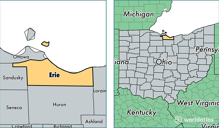
Erie County is a county equivalent area found in Ohio, USA. The county government of Erie is found in the county seat of Sandusky.
With a total 1,621.27 sq. km of land and water area, Erie County, Ohio is the 1650th largest county equivalent area in the United States. Home to 75,828 people, Erie County has a total 37614 households earning 46498 on average per year.
Erie County, Ohio offers the following attraction to visitors: Cedar Point Amusement
Erie County, Ohio - Quick Facts
| FIPS Code | 39043 |
| Area Codes | 419,440 |
| Time Zone | EST |
| Major Cities | Sandusky (population: 40,667), Vermilion (population: 15,819), Huron (population: 12,408), Castalia (population: 4,024), Milan (population: 3,272), Berlin Heights (population: 2,903), Kelleys Island (population: 309), Birmingham (population: 41) |
| Land Area | 29,277 sq miles |
| Water Area | 252 sq miles |
| Household Income | $46,498 |
| Housing Units | 37,614 |
| Median Home Value | $135,200 |
| High School Grads | 89% of population |
| Holders of Bachelors Degrees | 21% of population |
| Retail Spending | $13,377 per capita |
| Food & Accomodation Sales | $254,704 per capita |
| Universities and Colleges | Ohio Business College |
This page was last updated on June 30, 2016.