Where is Rockingham County, New Hampshire?
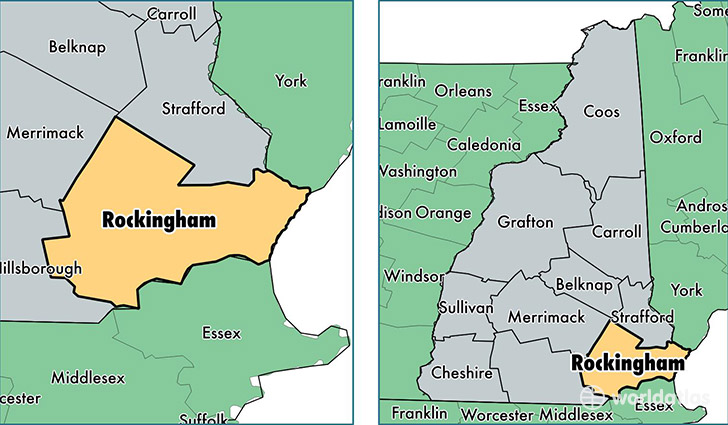
Rockingham County is a county equivalent area found in New Hampshire, USA. The county government of Rockingham is found in the county seat of Brentwood.
With a total 2,059.32 sq. km of land and water area, Rockingham County, New Hampshire is the 1189th largest county equivalent area in the United States. Home to 300,621 people, Rockingham County has a total 127443 households earning 77348 on average per year.
Rockingham County, New Hampshire offers the following attractions to visitors: USS Albacore (AGSS-569), Old North Church (Franklin Pierce)
Rockingham County, New Hampshire - Quick Facts
| FIPS Code | 33015 |
| Area Codes | 603 |
| Time Zone | EST |
| Major Cities | Derry (population: 33,561), Salem (population: 29,029), Londonderry (population: 24,167), Portsmouth (population: 21,721), Exeter (population: 21,139), Hampton (population: 15,479), Windham (population: 13,711), Raymond (population: 10,244), Newmarket (population: 9,085), Seabrook (population: 8,853) |
| Land Area | 116,070 sq miles |
| Water Area | 695 sq miles |
| Household Income | $77,348 |
| Housing Units | 127,443 |
| Median Home Value | $282,100 |
| High School Grads | 95% of population |
| Holders of Bachelors Degrees | 37% of population |
| Retail Spending | $21,603 per capita |
| Food & Accomodation Sales | $660,746 per capita |
This page was last updated on June 30, 2016.