Where is Washington County, Nebraska?
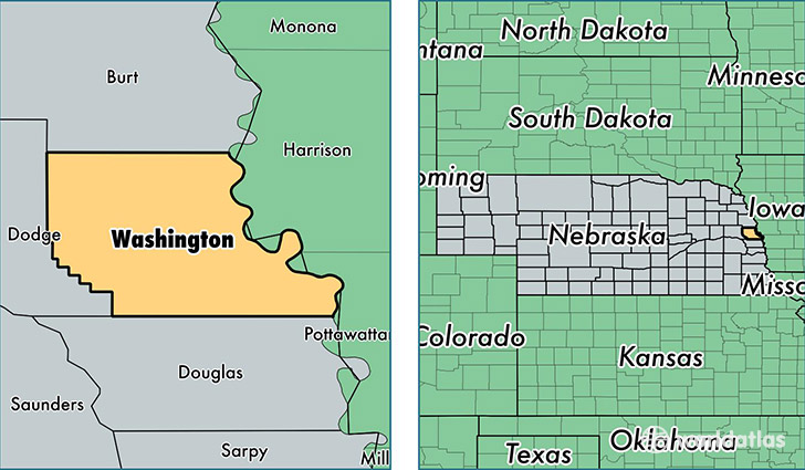
Washington County is a county equivalent area found in Nebraska, USA. The county government of Washington is found in the county seat of Blair.
With a total 1,018.37 sq. km of land and water area, Washington County, Nebraska is the 2629th largest county equivalent area in the United States. Home to 20,258 people, Washington County has a total 8334 households earning 65409 on average per year.
Washington County, Nebraska - Quick Facts
| FIPS Code | 31177 |
| Area Codes | 402 |
| Time Zone | CST |
| Major Cities | Blair (population: 12,295), Fort Calhoun (population: 2,538), Arlington (population: 2,151), Herman (population: 897), Kennard (population: 886), Nickerson (population: 720), Washington (population: 127) |
| Land Area | 7,822 sq miles |
| Water Area | 390 sq miles |
| Household Income | $65,409 |
| Housing Units | 8,334 |
| Median Home Value | $169,700 |
| High School Grads | 95% of population |
| Holders of Bachelors Degrees | 29% of population |
| Retail Spending | $32,377 per capita |
| Food & Accomodation Sales | $12,507 per capita |
This page was last updated on June 30, 2016.