Where is Dakota County, Nebraska?
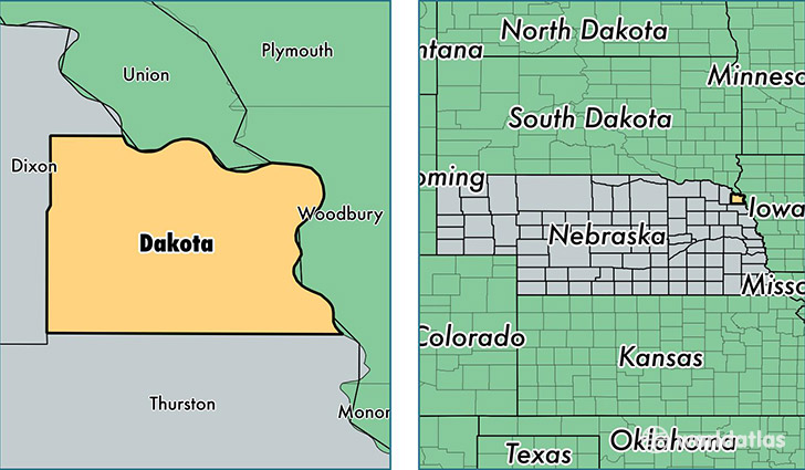
Dakota County is a county equivalent area found in Nebraska, USA. The county government of Dakota is found in the county seat of Dakota City.
With a total 692.62 sq. km of land and water area, Dakota County, Nebraska is the 2906th largest county equivalent area in the United States. Home to 20,850 people, Dakota County has a total 7703 households earning 47069 on average per year.
Dakota County, Nebraska - Quick Facts
| FIPS Code | 31043 |
| Area Codes | 402 |
| Time Zone | CST |
| Major Cities | South Sioux City (population: 15,382), Dakota City (population: 2,625), Emerson (population: 1,279), Homer (population: 831), Hubbard (population: 786), Jackson (population: 690) |
| Land Area | 8,050 sq miles |
| Water Area | 264 sq miles |
| Household Income | $47,069 |
| Housing Units | 7,703 |
| Median Home Value | $103,300 |
| High School Grads | 73% of population |
| Holders of Bachelors Degrees | 11% of population |
| Retail Spending | $8,368 per capita |
| Food & Accomodation Sales | $19,223 per capita |
This page was last updated on June 30, 2016.