Where is Mercer County, North Dakota?
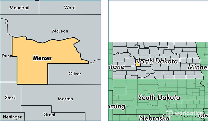
Mercer County is a county equivalent area found in North Dakota, USA. The county government of Mercer is found in the county seat of Stanton.
With a total 2,881.34 sq. km of land and water area, Mercer County, North Dakota is the 655th largest county equivalent area in the United States. Home to 8,746 people, Mercer County has a total 4643 households earning 66534 on average per year.
Mercer County, North Dakota offers the following attraction to visitors: Knife River Indian Villages NHS
Mercer County, North Dakota - Quick Facts
| FIPS Code | 38057 |
| Area Codes | 701 |
| Time Zone | CST |
| Major Cities | Beulah (population: 3,644), Hazen (population: 3,485), Stanton (population: 606), Zap (population: 458), Golden Valley (population: 366) |
| Land Area | 3,377 sq miles |
| Water Area | 1,043 sq miles |
| Household Income | $66,534 |
| Housing Units | 4,643 |
| Median Home Value | $113,600 |
| High School Grads | 89% of population |
| Holders of Bachelors Degrees | 21% of population |
| Retail Spending | $10,763 per capita |
| Food & Accomodation Sales | $8,162 per capita |
This page was last updated on June 30, 2016.