Where is Burke County, North Dakota?
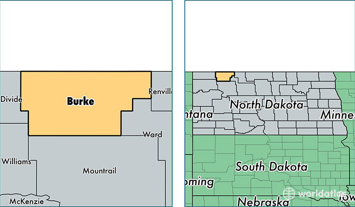
Burke County is a county equivalent area found in North Dakota, USA. The county government of Burke is found in the county seat of Bowbells.
With a total 2,923.97 sq. km of land and water area, Burke County, North Dakota is the 641st largest county equivalent area in the United States. Home to 2,245 people, Burke County has a total 1369 households earning 53693 on average per year.
Burke County, North Dakota - Quick Facts
| FIPS Code | 38013 |
| Area Codes | 701 |
| Time Zone | CST |
| Major Cities | Powers Lake (population: 762), Bowbells (population: 582), Columbus (population: 307), Lignite (population: 246), Flaxton (population: 154), Portal (population: 151) |
| Land Area | 867 sq miles |
| Water Area | 1,103 sq miles |
| Household Income | $53,693 |
| Housing Units | 1,369 |
| Median Home Value | $77,900 |
| High School Grads | 87% of population |
| Holders of Bachelors Degrees | 17% of population |
| Retail Spending | $9,718 per capita |
| Food & Accomodation Sales | $3,347 per capita |
This page was last updated on June 30, 2016.